As we approach the ten-year anniversary of NXT BLD, our 2017 selves would be amazed at just how far the AEC industry has come — and at the technology revolution right around the corner. With AI, design automation, and data-driven approaches poised to reshape...
Platform combines on-site imagery, AI and Procore / ACC integration to create and manage tasks OpenSpace Field is a new image-based solution that enables construction teams to capture and manage snagging items, observations and issues in real time as they walk the...
Global design practice migrates hundreds of workstations to virtualised workstation environment Grimshaw has completed the migration of its UK and European design teams onto Inevidesk’s virtual desktop infrastructure (VDI) platform. The move marks the replacement of a...
Add on LiDAR scanner turns smartphone into ‘long-range’ reality capture solution Q3D Sensing is gearing up for the Q2 launch of AuraGO, a compact reality capture device with a LiDAR sensor that attaches directly to a smartphone or tablet to deliver ‘high precision’...
Clash and deviation data pushed directly into the BIM collaboration platform, streamlining issue tracking and improving visibility across construction teams Hexagon Multivista has launched an integration between its Analyze deviation detection service and Revizto,...
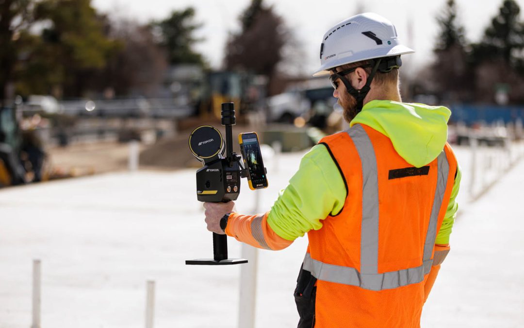
Integrates LiDAR, GNSS and panoramic imaging and boasts denser point clouds and longer range than CR-S2 Topcon Positioning Systems has introduced the CR-S1, a handheld scanning system that combines LiDAR, panoramic cameras, visual SLAM cameras, and a GNSS antenna in a...